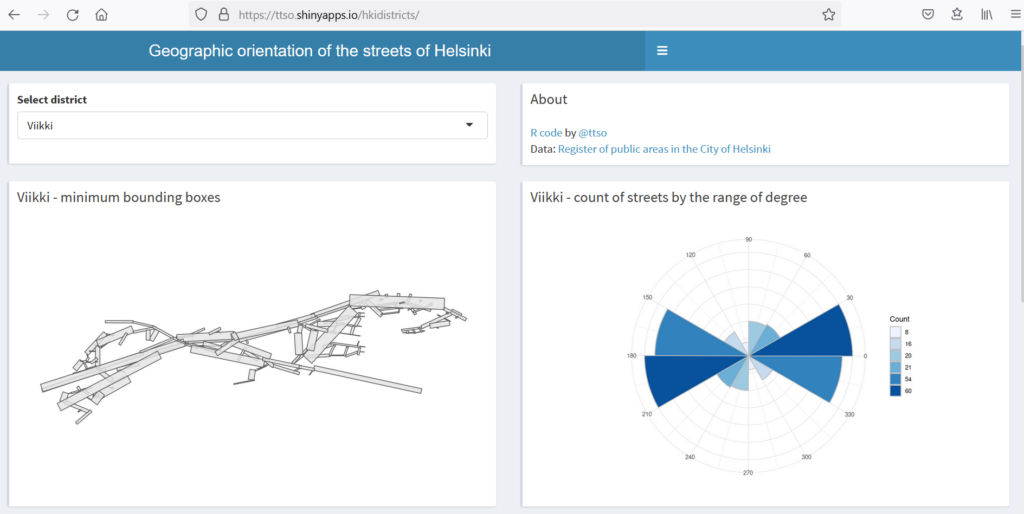
A Shiny app that shows the orientation of the streets of Helsinki by district, and of the whole city. Data comes from Register of public areas in the City of Helsinki.
The whole exercise might seem a little silly (and probably is too) but if anything, it made me realize e.g. how the district of Viikki looks like a galloping horse when you look at its streets from this perspective.
Having done that, I used the Python library OSMnx to plot polar histograms. Here is a notebook where I tell how it went, and why Pasila is not where it should be.
